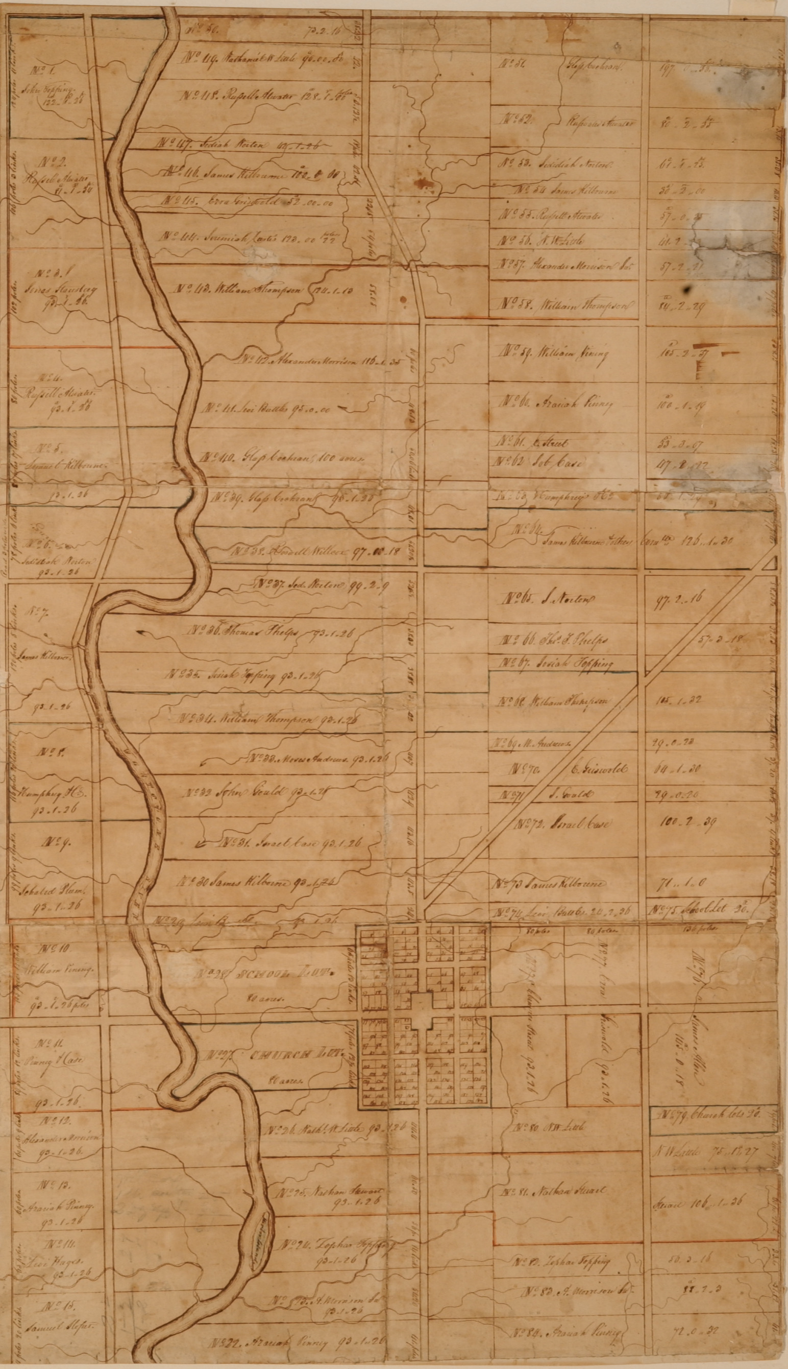
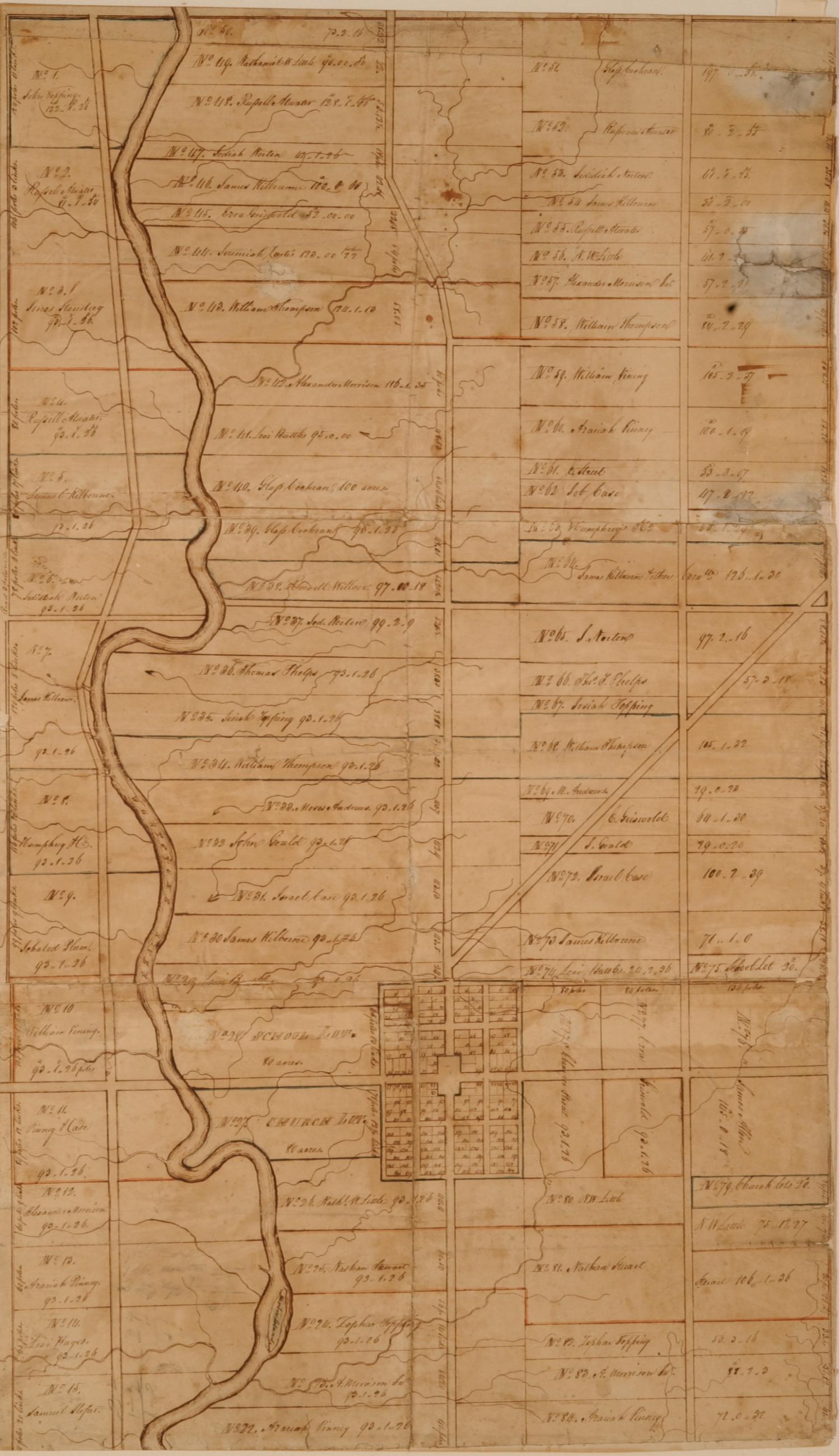
Plat of Sections 2 and 3 of Sharon Township
Basic details
Background
The map pictured here was drawn based on James Kilbourn's survey of the area. On the back of the plat of sections 2 and 3 of Sharon Township is written, "A Plat of the town of Worthington as laid off by the Proprietors and including the second and third Sections of the Second Township in the 18th Range of the United States Military Lands in the State of Ohio. Dated at Worthington, Aug. 11, 1804, James Kilbourn, Agent and Surveyor for the Company." A description accompanying the map states, "The four south lots were missing from the original plat. On Main Street (High Street) they were: No. 21, the Job Case farm; No. 20 the Bristol farm: No. 19, now owned by R. G. Hutchins: and No. 18, Beach's farm, now the Webster farm, adjoining the Clinton Tp. Line. On the west tier Nos. 15 and 16 are not shown."
Subjects
Record details
Copyright
Plat of Sections 2 and 3 of Sharon Township from the collections of the Worthington Historical Society (WHS) may be used for educational purposes as long as it is not altered in any way and proper credit is given: "Courtesy of the Worthington Historical Society, Worthington, OH." Prior written permission of the WHS is required for any other use of Plat of Sections 2 and 3 of Sharon Township. Contact WHS at info@worthingtonhistory.org to request permission.


