Aerial Photograph of South Worthington ca. 1930s

Basic details
Background
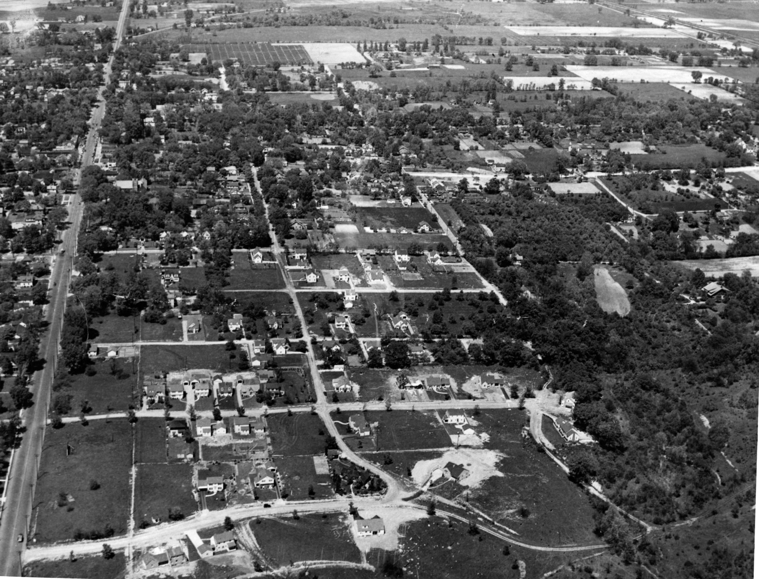
This photograph shows an aerial view of south Worthington, possibly taken sometime during the 1930s. High Street is visible on the left side of the photo, extending northward from the bottom-left corner of the frame, and Southington Avenue is visible just above the bottom of the frame, running eastward.
Worthington United Methodist Church can be seen approximately two-thirds of the way up from bottom of the frame, on the east side of High Street; due-north of there, Worthington’s first water tower can be seen rising above the treetops, with the gleaming roof of St. John’s Episcopal Church (immediately beyond it to the north) highlighting one of the darkly-painted support beams of the water tower. Part of Worthington Elementary and Junior High School (now Kilbourne Middle School) is visible through a gap in the treeline just beyond the water tower and Episcopal Church.
Conspicuously absent from this photograph along its top third, where Worthington-Galena road arcs northeastward from High Street, are residential developments: neighborhoods that as of 2021 can be found just south of Worthington-Galena – including Wilson Hill and Worthington Acres – appear mostly empty. Likewise, the areas depicted in the bottom half of the photo and toward the right side of the frame – where, as of 2021, the Park Highlands and Morris neighborhoods are located – are noticeably populated more with trees and empty lots than with houses.
Subjects
Record details
Copyright
Aerial Photograph of South Worthington ca. 1930s from the collections of the Worthington Historical Society (WHS) may be used for educational purposes as long as it is not altered in any way and proper credit is given: "Courtesy of the Worthington Historical Society, Worthington, OH." Prior written permission of the WHS is required for any other use of Aerial Photograph of South Worthington ca. 1930s. Contact WHS at info@worthingtonhistory.org to request permission.


